The Great Oregon Cookie Map
We seem to be averaging an edible family homework project each grade. (Last year, it was the Broadway Bridge that we made out of licorice.)
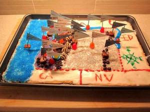
As if we didn’t have enough to do this winter, Zelda’s elementary school teacher piled on with an assignment to create an edible map of Oregon. (Click to enlarge photos.) We needed to represent and label all bordering states, major rivers, major mountains and mountain ranges, cities, regions, Crater Lake, and the Pacific Ocean. And, with the exception of the labels, everything needed to be consumable.
Zelda and I put our heads together and decided to build from sugar cookie and glaze.
First task was a shopping trip for the wee-est blonde daughter and myself. Armed with her list of topographical necessities, Zelda and I trolled the candy aisles muttering about mountains and cities, drawing our fair share of strange looks. We decided on Hershey’s Hugs for major mountains, Kisses for major mountain chains, and chocolate chips for smaller mountain chains. For cities, we opted to use Dots to anchor the toothpick flags. Cut up giant Tootsie Roll planks anchored labels for mountain chains. And, of course, we bought all manner of wretched artificially colored frosting…and food coloring…and sugar sprinkles…and cake decorations.
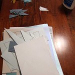
Day 1: Zelda selected five sheets of cardstock and we came up with a color coding system for labels. She then cut out zillions of little triangles, labeled them, and glued them to color coded toothpicks. (Picture 1 below.) This was followed by the creation of a paper stencil of the state and its four regions.
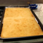
Day 2: We baked the giant butter cookie. (Picture 2 below.)
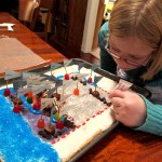
Day 3: This sucker came together fast, and we needed all hands on deck to get everything situated before the glaze set. We began by placing the stencil on the cookie and frosting Oregon, which was followed by a quick sugaring of each region with its own unique color using our regional stencils. As I glazed the states around Oregon, Zelda and Tom madly placed labels in Dots and Tootsie Roll bases, which were located on the map along with the chocolate mountain ranges. We topped off the topography with unnatural neon blue frosted water features, and a neon blue sugared Pacific Ocean. The final step was laying down borders and drawing the compass rose. (Zelda working on a border in Picture 3 below.)
I am happy to report that our map was not only great looking with lots of extra credit features, but it tasted freaking amazing. A big family argument over who got to eat the Cascade Mountain range ensued!!


